Fire Intensity Estimation

 Project title: A novel approach to estimate fire intensity and carbon emissions over a decade of fires in Poland
About the project:
Scientific partner:
MSC Student:
A MSc student Urszula Pytlak from the Department of Geography (faculty: Geoinformatics and Remote Sensing), University of Warsaw was granted with a master thesis stipend founded through the project by the Foundation for Polish Science. Urszula Pytlak is currently working on her MSc dissertation under dr. Agata Hościło (IGiK) and dr. hab Bogdan Zagajewski (UW) supervision.
Urszula Pytlak is a very active student, she is a member of the management board of the Geoinformatics and Remote Sensing Student’s Association (KNGiT UW). She was involved in organizing the GIS Day 2013 and GIS day 2014. Now, she is involved in organizing the Earsel & ISPRS Young Scientist Days (16-20 June 2014), where she is going to give an oral presentation on ‘Spatio-temporal distribution of active fires from MODIS over Poland for the period 2001-2013’.
Achievements:
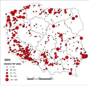
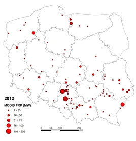
Fire intensity expressed as Fire Radiative Power (MWats) for the fires recorded by MODIS in 2003 (on the left) and 2013 (on the right).
- Fires that occured in summer and spring are more intensive that autumn's fires
- Extremely intensive fires occure more often in summer and autumn time
- The analysis of variability of fire intensity in relation to land cover type confirmed that the most intensive fires took place in wetland areas
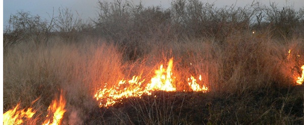
The first experimental prescribed burning in moorlands in Poland visible for satellite: LINK
Agata Hościło was invited by the Polish Academy of Science to give a presentation at the 3rd workshop of the International Biomass Burning Initiative (IBBI) in Schloss Ringberg, Germany, 23-26 April 2014. Title of the presentation: ‘Long term consequences of burning on peatland vegetation and carbon dynamics’.
Agata Hościło gave an oral presentation at the 34th Earsel Symposium 2014 in Warsaw 16-20 June 2014. Title of the presentation: ‘Can remotely sensed data be used to support monitoring of fires in Poland?’.
Agata Hościło gave a poster presentation at the 2014 IEEE International Geoscience and Remote Sensing Symposium and 35th Canadian Symposium on Remote Sensing (IGARSS2014), 13-18 July 2014, Quebec, Canada. Title: 'Use of satellite data for monitoring fire events in Poland'.
 Publi
Publi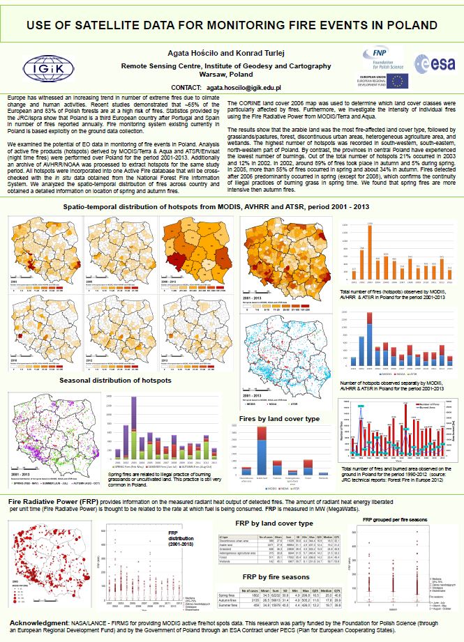 cations:
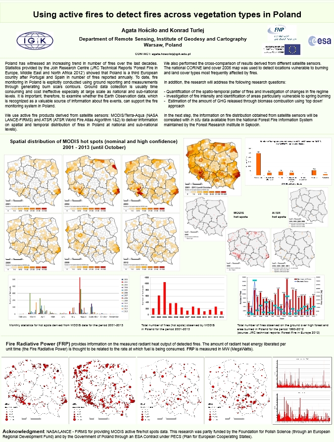
Hościło A., Turlej K., 2013, Using active fires to detect fires across vegetation types in Poland, the 9th EARSeL Forest Fire Workshop in Coombe Abbey, UK, 15-17 October 2013.
Hościło A., Turlej K., 2014, Use of satellite data for monitoring fire events in Poland, Proc. 2014 IEEE International Geoscience and Remote Sensing Symposium and 35th Canadian Symposium on Remote Sensing (IGARSS2014), 13-18 July 2014, Quebec, Canada, pp. 828-831; 978-1-4799-5775-0/14/.0000 ©2014 IEEE.
Important links:
Forest Fire Danger map prepared by the Forest Fire Protection Laboratory
http://bazapozarow.ibles.pl/zagrozenie/

