SAT4EST
 SAT4EST - Earth observation based service supporting local administration in non-state forest management
Project consortium:
Taxus.IT - responsible for project management and for designing and developing the web-based platform for the service. http://taxusit.com.pl/
IGIK - responsible for development and production of EO based products and promoting of the EO data.
Task leader at IGiK: PhD Eng. Agata Hoscilo
Contact: agata.hoscilo@igik.edu.pl
More about the project: http://www.igik.edu.pl/pl/Aplikacja-SAT4EST
The goal of the SAT4EST is to design and build non-state forest focused service dedicated to the local government administration in Poland. The proposed service will promote the use of various Copernicus data and products to the large community of end users at administrative level.
The detailed objectives are:
- to prepare EO products that will meet the user requirements,
- to demonstrate how EO products can be integrated with ancillary data,
- to design and develop web-based service for forest management,
- to implement the service in the selected districts.
The proposed EO based service will provide a simple, intuitive and low cost tool in a form of a web-based application easy to use and expand for other dataset. It will integrate EO based products, ancillary data and will allow calculating statistics over a given area and generating simple reports.
It will support users for:
• preparing a tender for assembling forest inventory plans,
• identifying discrepancies between cadastral land records and actual status on the ground,
• verifying and accepting the existing forest inventory plan,
• monitoring execution of the tasks assigned in the inventory plans,
• verifying the whole plan after ten years,
• monitoring forest changes.
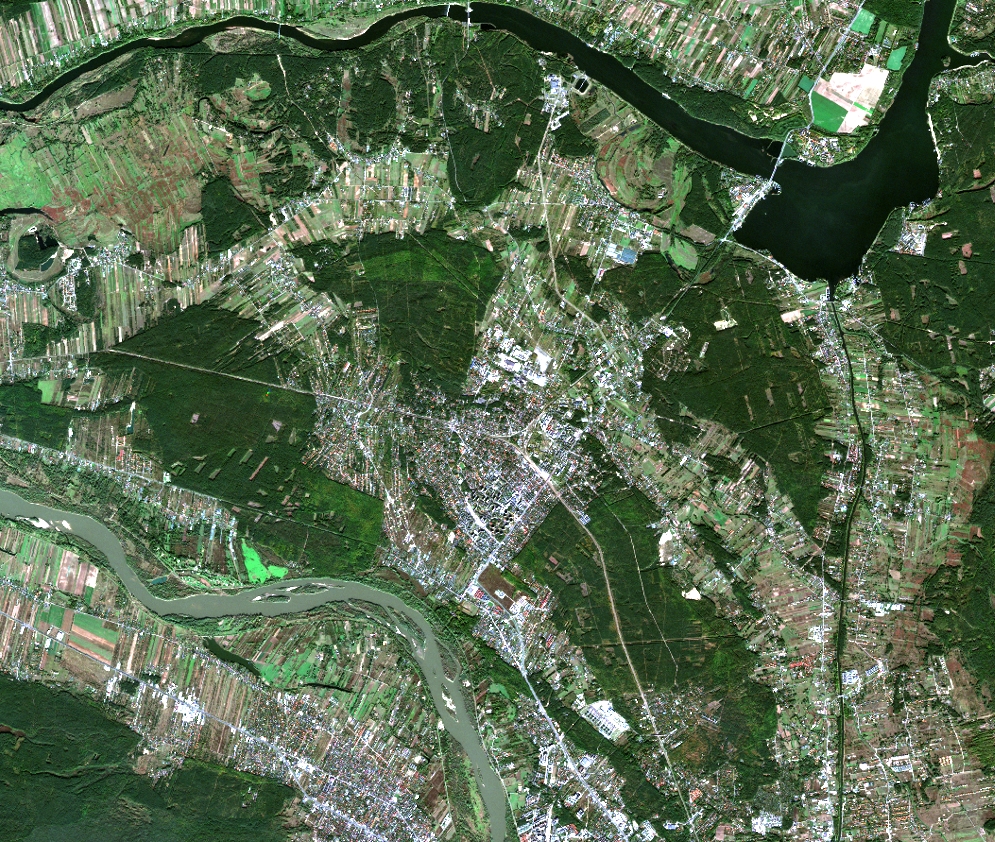
SAT4ESt service  will be implemented in three selected districts: Nowy Targ, Sieradz and Legionowo located in Poland. Each of the selected districts has different problems related to forest management. There is, for example a large discrepancy between land records and status on the ground in Nowy Targ district. The large proportion of the forest is a remote mountain forest, which is difficult to govern and map. There is also a problem with the abandon land subject to natural succession. In Sieradz district located on lowland, the non-state forest is easier to manage however the forest patches are rather small and scattered. Legionowo District is located on outskirts of Warsaw, thus its subject to anthropogenic pressure related to urbanization.
Left: Satellite image from Sentinel-2 registered on 2016/10/17 over the Legionowo District. Credits: Remote Sensing Centre of IGiK
Duration of the project: 1.03.2017 – 28.02.2019
Funded by: the European Space Agency (ESA)


