New research paper by the Remote Sensing Centre in the Scientific Reports - Nature Portfolio
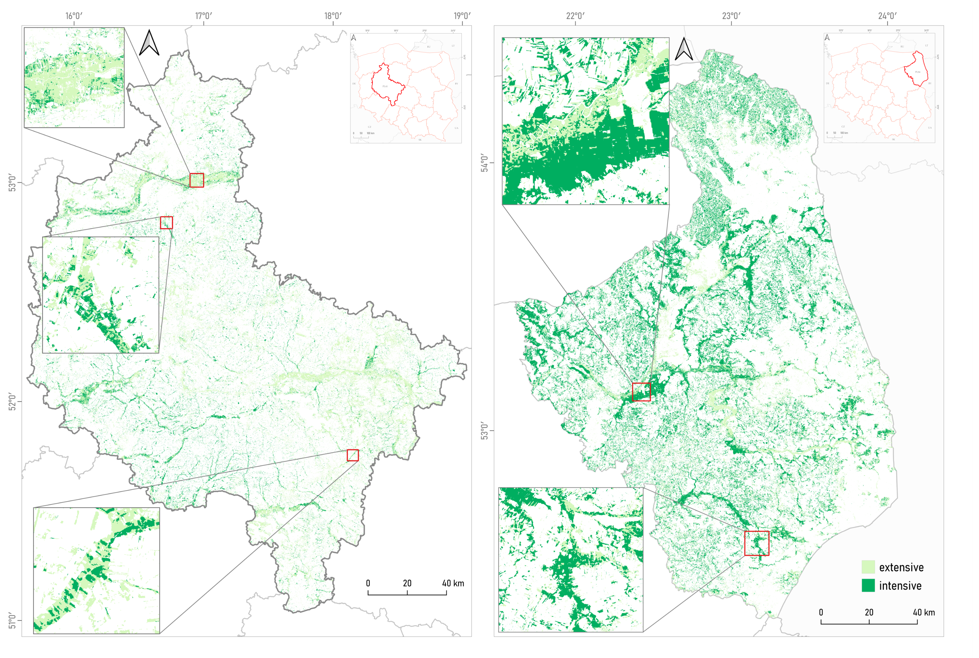
A new article by the Remote Sensing Centre, IGiK has been published in the Scientific Reports, issued by the international publisher Springer Nature. The paper, entitled Mapping management intensity types in grasslands through the synergistic use of Sentinel-1 and Sentinel-2 satellite images, presents the results of research on the application of a machine learning algorithm for satellite-based identification of grasslands managed intensively and extensively for agricultural purposes. In this study, both radar images from Sentinel-1 satellites and optical images from Sentinel-2 satellites were used. To verify the obtained grassland classification results, field observation data collected in the Podlaskie Voivodeship by the Remote Sensing Centre, IGiK and in the Wielkopolskie Voivodeship by the Department of Grassland and Natural Landscape Sciences, Poznań University of Life Sciences
It was found that the total area of extensively managed grasslands (seminatural) in the Wielkopolskie Voivodeship is just under 1385 km², while intensively managed grasslands (mown multiple times a year) cover over 4067 km². In relation to the total area of the grasslands in the voivodeship, they represent 25.4% and 74.6%, respectively. In the Podlaskie Voivodeship, it was found that the area of extensively managed grasslands is 4914 km², while intensively managed grasslands cover over 3459 km². These areas represent 58.1% and 40.9% of the total area of the grasslands in Podlaskie. The results of satellite detection of intensively and extensively managed grasslands are consistent with observations indicating significant spatial diversity in their use across Poland. Our calculations revealed that the proportion of permanent grasslands in the agricultural land structure in the Podlaskie Voivodeship was significantly higher than in the Wielkopolskie Voivodeship, amounting to 41.9% and 18.2%, respectively.
This research was funded by the National Centre for Research and Development (NCBiR) as part of the Polish-Norwegian Research Cooperation Program, project GrasSAT – Tools for information to farmers on grasslands yields under stressed conditions to support management practices. No. of agreement NOR/POLNOR/GrasSAT/0031/2019-00
Bartold, M., Kluczek, M., Wróblewski, K. et al. Mapping management intensity types in grasslands with synergistic use of Sentinel-1 and Sentinel-2 satellite images. Sci Rep 14, 32066 (2024). https://doi.org/10.1038/s41598-024-83699-4 IF 3.8, 140 pts. MNiSW


