Modern Satellite Technologies: Application of Sentinel-1 Mosaics to Monitor Surface Changes in Poland
Modern Satellite Technologies: Application of Sentinel-1 Mosaics to Monitor Surface Changes in Poland
In the era of dynamic climate and anthropogenic changes, modern satellite technologies play a key role in monitoring and managing space and agricultural resources. The Institute of Geodesy and Cartography has developed National Change Mosaics, based on radar images of the Copernicus Sentinel-1 Program from 2021, 2022 and 2023. The mosaics were created as part of the FPCUP Agriculture[i] project, which aimed to provide valuable tools to support the Agency for Restructuring and Modernization of Agriculture. (ARiMR) and the National Center for Support for Agriculture (KOWR), as well as regional and local agencies, in their activities for the agricultural sector in Poland. Thanks to advanced analyzes of radar images, mosaics enable detailed monitoring of seasonal and interannual changes taking place in our country.
Methodology, application and interpretation of the Sentinel-1 Change Mosaic (2021-2022-2023)
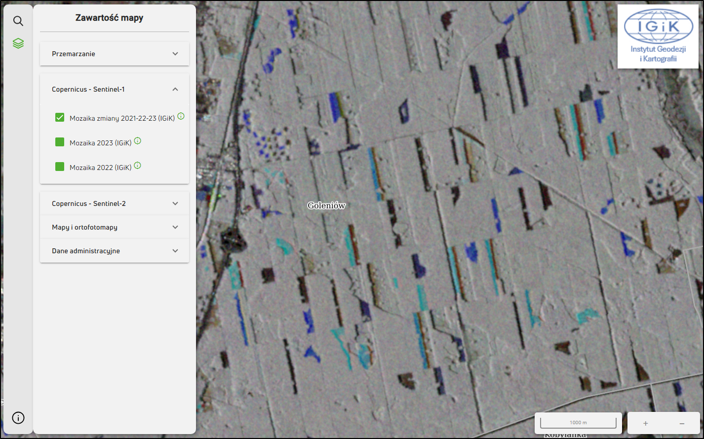
The Sentinel-1 National Change Mosaic was developed on the basis of data collected in the period April-September 2021, 2022 and 2023. Using radar imaging technology, the mosaic presents changes in the condition of the analyzed surface in different growing seasons. Each of the three RGB image layers corresponds to a different growing season, which allows you to identify changes in interannual periods.

In the presented RGB composition, different colors correspond to specific changes in the condition of the analyzed surface:
- Light blue: may indicate forest clearing carried out in 2022-2023.
- Darker blue: may mean forest clearing in 2021-2022.
- Orange and red colors: suggest the creation of new construction investments (road infrastructure, new housing estates, other buildings) in the periods 2022-2023 and 2021-2022, respectively.
- White, gray, black colors: allow the identification of areas with a stable structure, without significant changes in the period 2021-2023, such as forests, built-up areas and water bodies.

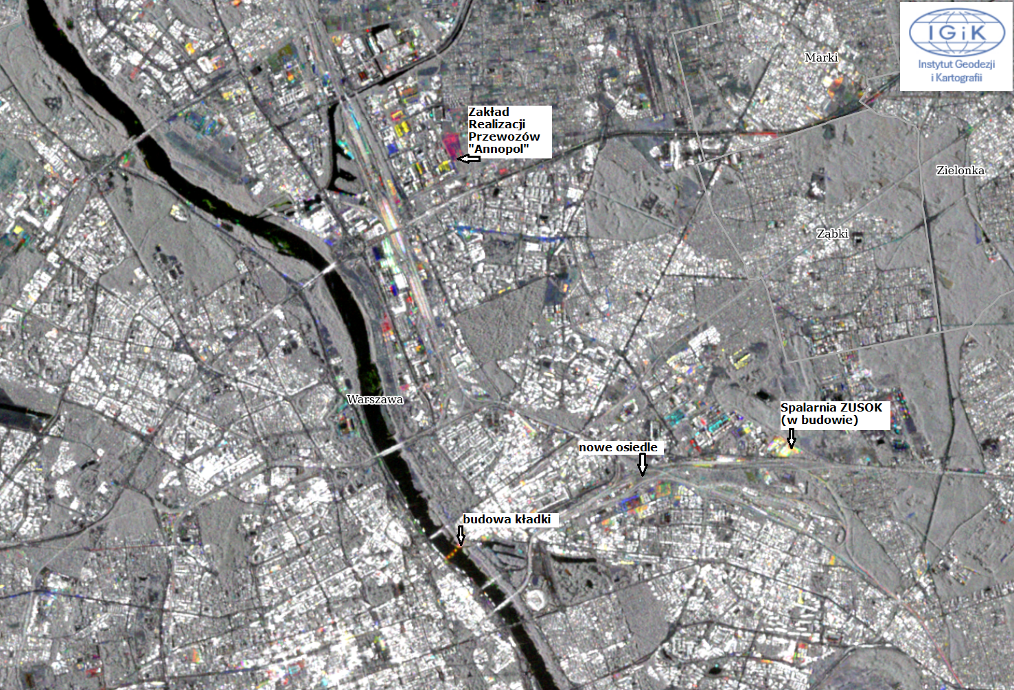
The above map of Warsaw shows examples of new construction investments in 2022-2023 and 2021-2022, such as:
- Fbridge on the Vistula - a pedestrian and bicycle footbridge on the Vistula in Warsaw, connecting Powiśle with Stara Praga
- expansion of the Municipal Solid Waste Disposal Plant (ZUSOK), a modern waste incineration plant on the border of Targówek and Rembertów in Warsaw.
- construction of a tram depot in the Białołęka district - Transport Implementation Plant "Annopol"
- new residential estate at ul. Żupnicza
Sentinel-1 Seasonal Change Mosaics (2022 and 2023)
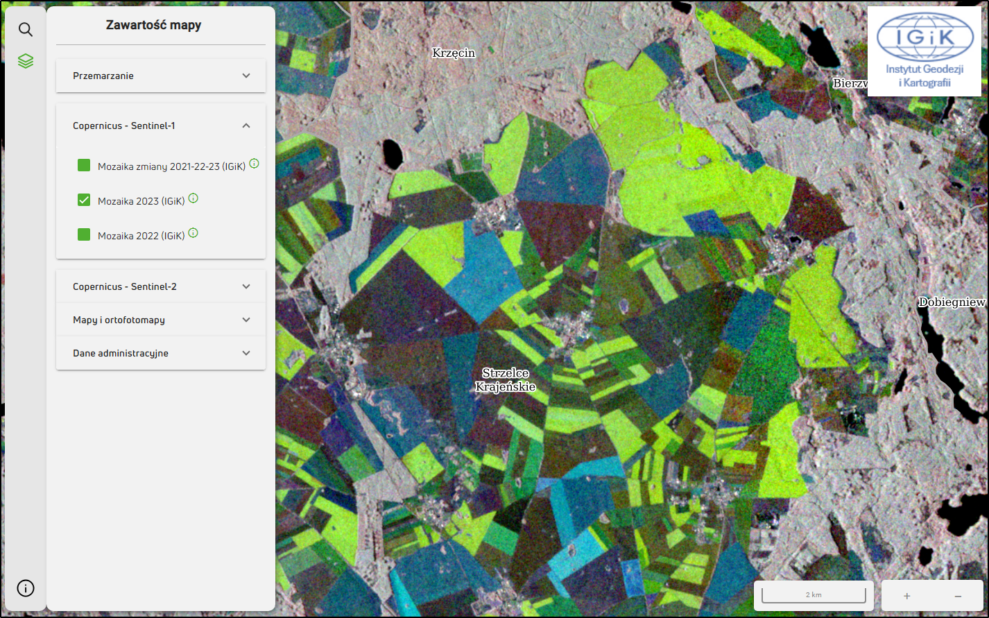
In addition to the Sentinel-1 National Change Mosaic, seasonal mosaics have been developed for 2022 and 2023, where individual RGB channels of the mosaic correspond to products composed of data from two-month periods (R - April/June, G – July/August, B – September/October). Their interpretation allows, among others, to assess agricultural areas in terms of crops/crop groups occurring there, e.g. yellow colors may indicate the presence of winter crops, while blue colors may suggest the presence of spring crops or uncovered soil in the early part of the season.

Sentinel-1 National Mosaics, developed by the Institute of Geodesy and Cartography, are an innovative tool for monitoring changes in the surface condition in Poland. The use of data from radar imagery enables precise tracking of seasonal and interannual changes, which is invaluable for both agricultural agencies and individual farmers. Thanks to the support of the Copernicus program, Poland gains modern solutions that help manage agricultural resources in the face of dynamic climate change.
More information and a detailed description of product interpretation can be found at https:// fpcup.pl/agri/, and maps on the website at the link https://serwisagri.fpcup.pl/.
[i] Funding: Caroline Herschel Framework Partnership Agreement on Copernicus User Uptake, FPA 275/G/GRO/COPE/17/10042, European Commission; An international project co-financed by the program of the Minister of Science and Higher Education entitled “PMW” in 2019-2021; contract no. 275/G/GRO/COPE/17/10042; 202010-SI2.833214
