Inventory of actual forest extent
 Mapping of actual forest extent in Poland using existing photogrammetric, remote sensing and spatial datasets
Project leader: Dr. Eng. Agata Hoscilo
Duration of the project: February – August 2015
The aim of the project was to map the actual forest extent over Poland using the following spatial data sets: Digital Forest Map, Topographic Database, Database of Parcel Identification System, High Resolution Forests layer (HRL - Copernicus product), and Forest Data Bank.
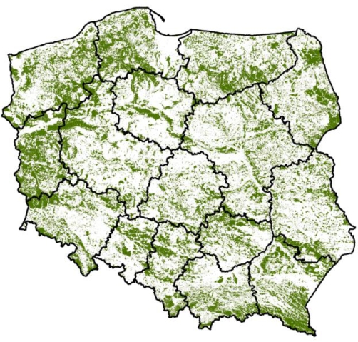
Actual forest extent map, which is the result of this project, refers to the definition of forest as defined in the Forest Act of 28 September 1991. (Dz. U. 1991 No. 101, item. 444, Article 3). This includes all forms of ownership forests and areas that are forested but officially recorded as non-forest. Forest by definition is a homogeneous area of 0.1 hectares. Forested areas that meet an additional criteria of the forest definition under the Kyoto Protocol were masked out.
The project was funded by the State Forests National Forest Holding.
Contact: agata.hoscilo@igik.edu.pl


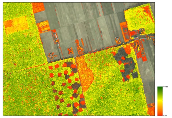
Figure 1. Height of the vegetation in meters based on the cloud points from LIDAR. Credits: IGiK
Figure 2. Map of forest extent determined by the Institute of Geodesy and Cartography. Credits: IGiK
