Preparation of the forest biomass maps for Poland


Project leader: prof. Christianne Schmullius, Friedrich-Schiller-Universität Jena.
Project duration: 01.2015 – 12.2017
The main purpose of the ESA Due GlobBiomass project is to better characterize and to reduce uncertainties of forest aboveground biomass estimates by developing an innovative synergy mapping approach in five regional sites for the epochs 2005, 2010 and 2015 and for one global map for the year 2010. The project team includes the leading Earth Observation experts of Europe (14 institutions from 8 European countries) and is linked through Partnerships Agreements with further national bodies from Brazil, Canada, Chine, Russia and South Africa.
The ESA DUE GlobBiomass project is managed and coordinated by the Department of Earth Observation at the Friedrich-Schiller-University Jena, Germany
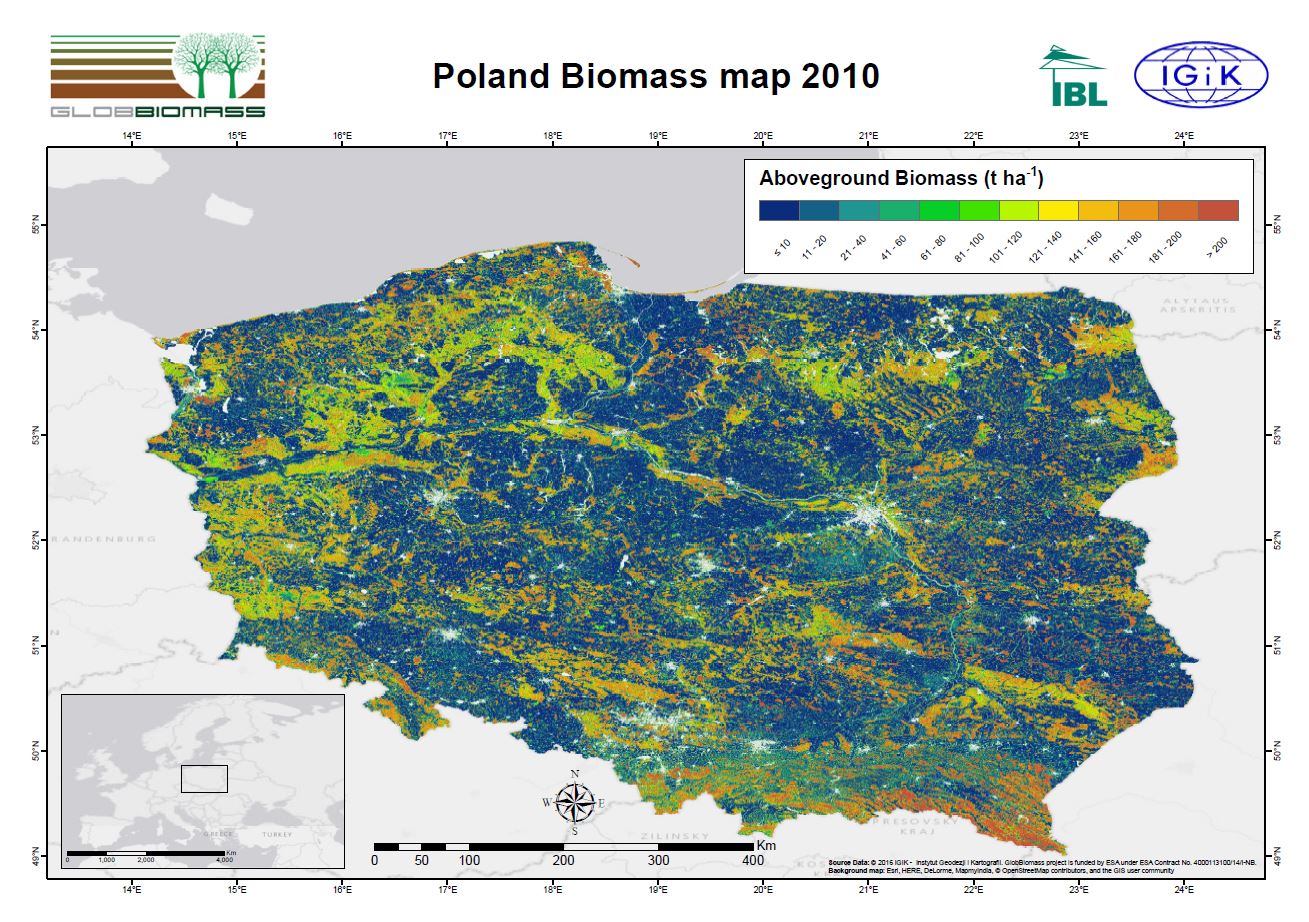
The Remote Sensing Centre at the Institute of Geodesy and Cartography (IGIK) in cooperation with the Forest Research Institute (IBL) is responsible for developing a methodology for forest biomass retrieval and preparation of the forest biomass maps for Poland the epochs 2005, 2010 and 2015. The first forest biomass map for 2010 has been released. The map was developed based on a synergy of radar ALOS Palsar and optical Landsat missions data. The national Large Scale Forest Status Inventory (WISL) data has been used as the reference data for the biomass retrieval.
Task leader at IGiK: Dr. Eng. Agata Hoscilo
Contact: agata.hoscilo@igik.edu.pl
Contact in IBL: Dr. Eng. Krzysztof Sterenczak
Read more on project: http://globbiomass.org/
Forest Aboveground Biomass in Poland 2010. Credits: IGiK

